WISH (v2.0)
WISH (Web Information System Hyperlink) was created to make the National Cave Registry of Italy freely accessible. Version 2.0 represents its natural evolution. Among its objectives is to complete the GIS map of Italian natural caves.
Regions currently in the Wish archive:
| Regione | Portale |
|---|---|
| ABRUZZO | Federazione Speleologica Abruzzese ETS (Dati Wish1.0, no Mappa) |
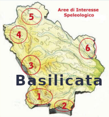
| BASILICATA | Gruppi Speleologici Lucani (Dati Wish1.0, no Mappa) |
| CAMPANIA | Federazione Speleologica Campana |
| EMILIA-ROMAGNA | Federazione Speleologica EmiliaRomagna |
| FRIULI VENEZIA GIULIA | Regione Autonoma Friuli Venezia Giulia |
| LAZIO | Federazione Speleologica del Lazio |
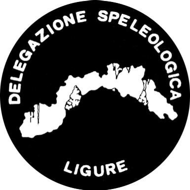
| LIGURIA | Delegazione Speleologica Ligure |
| LOMBARDIA | Federazione Speleologica Lombarda |
| PIEMONTE | Associazione Gruppi Speleologici Piemontesi |
| PUGLIA | Federazione Speleologica Pugliese |
| SARDEGNA | Federazione Speleologica Sarda |
| SICILIA | Federazione Speleologica Regionale Siciliana (Dati Wish1.0, no Mappa) |
| TOSCANA | Federazione Speleologica Toscana |
| UMBRIA | Federazione Umbra Gruppi e Speleologi (Dati Wish1.0, no Mappa) |
| VENETO | Federazione Speleologica Veneta (Dati Wish1.0, no Mappa) |
The longest and deepest caves currently listed in Wish:
The data currently present is calculated based on the regions surveyed,
In the case of caves with multiple entrances, the name of the cave with the lowest land register number is displayed.
To date there are 45874 caves.
In the case of caves with multiple entrances, the name of the cave with the lowest land register number is displayed.
To date there are 45874 caves.
Longest Caves:
| BUCA DEI GRACCHI (Complesso Carsico del M. Corchia): | 74000 m. | TOSCANA |
|---|---|---|
| ABISSO PIERO SARAGATO (Complesso della Carcaraia, Pozzo Firenze): | 70000 m. | TOSCANA |
| Carsena di Piaggia Bella (VORAGINE DEL COLLE DEL PAS, Q327): | 43000 m. | PIEMONTE |
| SISTEMA CARSICO DELLA CODULA ILUNE (SU PALU - GRUTTA 'E MONTE LONGOS O): | 42000 m. | SARDEGNA |
| INGRESSO FORNITORI : | 35723 m. | LOMBARDIA |
| Abisso Michele Gortani (A 10,P 4): | 26600 m. | FRIULI VENEZIA GIULIA |
| Grotta di Monte Cucco (Caverna di Monte Cucco): | 25000 m. | UMBRIA |
| Grotta della Mottera (MUTERA): | 22279 m. | PIEMONTE |
| BUENO FONTENO : | 21447 m. | LOMBARDIA |
| Labassa (Q524): | 20000 m. | PIEMONTE |
| GROTTA PRESSO LA CAPANNA STOPPANI (BÜS DEL DOSSOR; POZZO PRESSO LA CAPANNA STOPPANI; POZZO PRESSO RIFUGIO STOPPANI): | 19794 m. | LOMBARDIA |
Deepest Caves:
| ABISSO PAOLO ROVERSI : | 1350 m. | TOSCANA |
|---|---|---|
| W LE DONNE : | 1282 m. | LOMBARDIA |
| ABISSO OLIVIFER : | 1215 m. | TOSCANA |
| BUCA DEI GRACCHI (Complesso Carsico del M. Corchia): | 1185 m. | TOSCANA |
| ABISSO PIERO SARAGATO (Complesso della Carcaraia, Pozzo Firenze): | 1172 m. | TOSCANA |
| ABISSO PERESTROIKA : | 1160 m. | TOSCANA |
| BUCA DEL MUSCHIO (Abisso Satanachia): | 1042 m. | TOSCANA |
| BUCA GO FREDO : | 1030 m. | TOSCANA |
| ABISSO DELLA TAMBURA (Complesso del M. Tambura, Buca del Pianone): | 1008 m. | TOSCANA |
| Abisso Michele Gortani (A 10,P 4): | 980 m. | FRIULI VENEZIA GIULIA |
| ABISSO DI MALGA FOSSETTA : | 974 m. | VENETO |
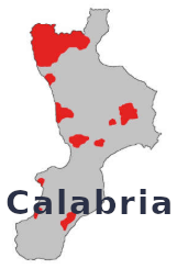
Logos of the Italian speleological regions: